
Feed aggregator
Photos reveal unexpected details from the world's first atomic test
Photos reveal unexpected details from the world's first atomic test
How a visit to Stonehenge reminded me of deep time
How a visit to Stonehenge reminded me of deep time
Can we harness quantum effects to create a new kind of healthcare?
Can we harness quantum effects to create a new kind of healthcare?
PMOS shows us why many scientific terms need to be renamed
PMOS shows us why many scientific terms need to be renamed
This is the most underrated sci-fi film franchise of the 21st century
This is the most underrated sci-fi film franchise of the 21st century
Shiver me timbers: Do we have to worry about space pirates now?
New Scientist recommends a devastating account of farming honeybees
Shiver me timbers: Do we have to worry about space pirates now?
New Scientist recommends a devastating account of farming honeybees
These bizarre fossils represent some of the earliest moving, sexually reproducing life ever discovered
New trove of fossils reveals that ancestral animals likely emerged in the deep sea
Psyche Spacecraft Completes Mars Flyby
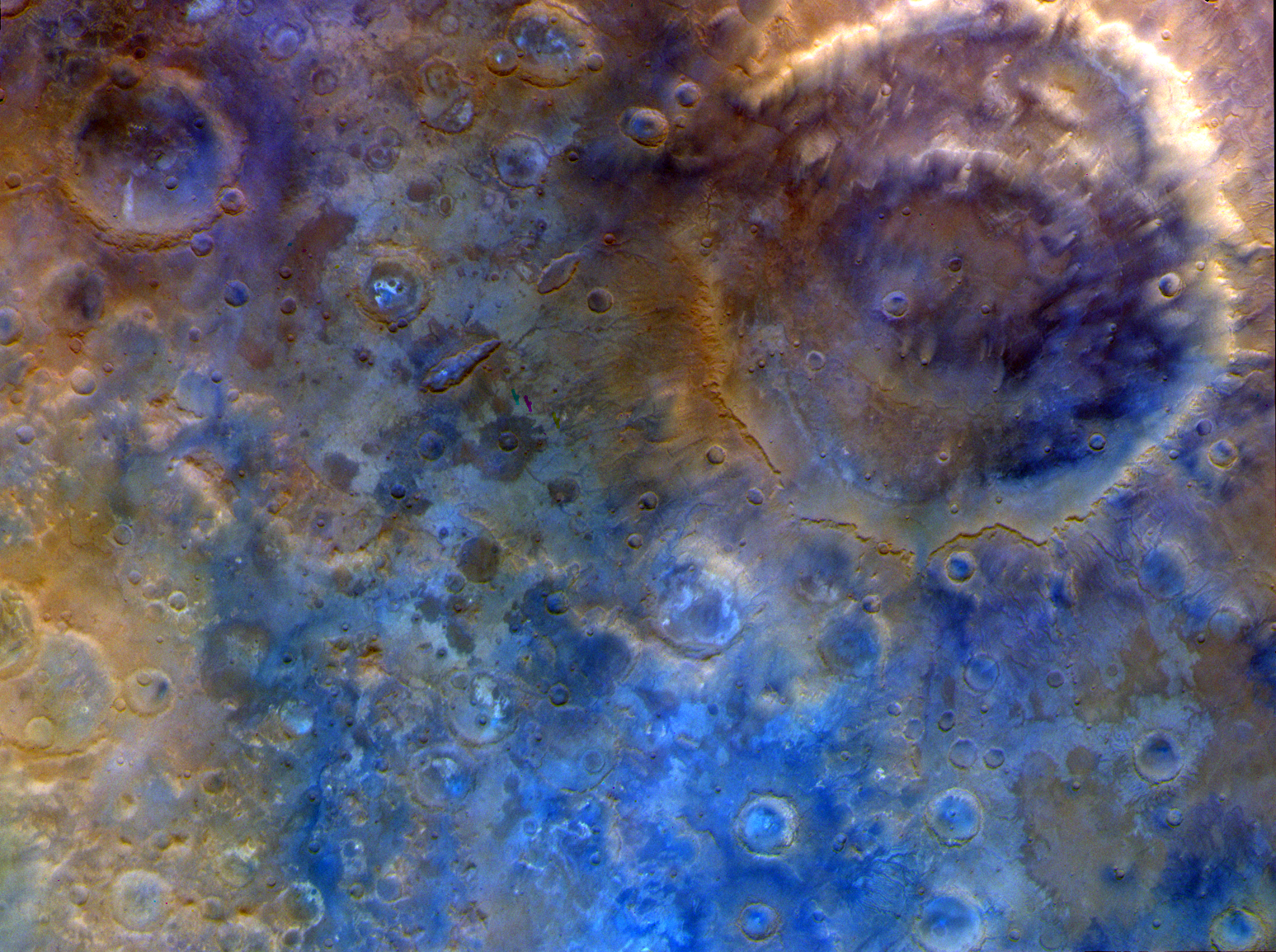
NASA’s Psyche spacecraft completed its close approach of Mars on May 15, coming within 2,864 miles (4,609 kilometers) of the planet’s surface. During the flyby, it took this image and others. This representative color image, captured by Psyche’s multispectral imager instrument, features the double-ring crater Huygens and the surrounding heavily cratered southern highlands.
This flyby used a gravity assist from Mars to provide a critical boost in speed and to adjust the spacecraft’s orbital plane without using any onboard propellant, sending it on its way toward the metal-rich asteroid Psyche. When it arrives in August 2029, it will insert itself into orbit, then map the asteroid and gather science data. If the asteroid proves to be the metallic core of an ancient planetesimal, it could offer a one-of-a-kind window into the interior of rocky planets like Earth.
Learn more about the flyby and see more photos from the event.
Image credit: NASA/JPL-Caltech/ASU
Psyche Spacecraft Completes Mars Flyby
NASA’s Psyche spacecraft completed its close approach of Mars on May 15, coming within 2,864 miles (4,609 kilometers) of the planet’s surface. During the flyby, it took this image and others. This representative color image, captured by Psyche’s multispectral imager instrument, features the double-ring crater Huygens and the surrounding heavily cratered southern highlands.
This flyby used a gravity assist from Mars to provide a critical boost in speed and to adjust the spacecraft’s orbital plane without using any onboard propellant, sending it on its way toward the metal-rich asteroid Psyche. When it arrives in August 2029, it will insert itself into orbit, then map the asteroid and gather science data. If the asteroid proves to be the metallic core of an ancient planetesimal, it could offer a one-of-a-kind window into the interior of rocky planets like Earth.
Learn more about the flyby and see more photos from the event.
Image credit: NASA/JPL-Caltech/ASU
NASA-developed AI Could Help Track Harmful Algae
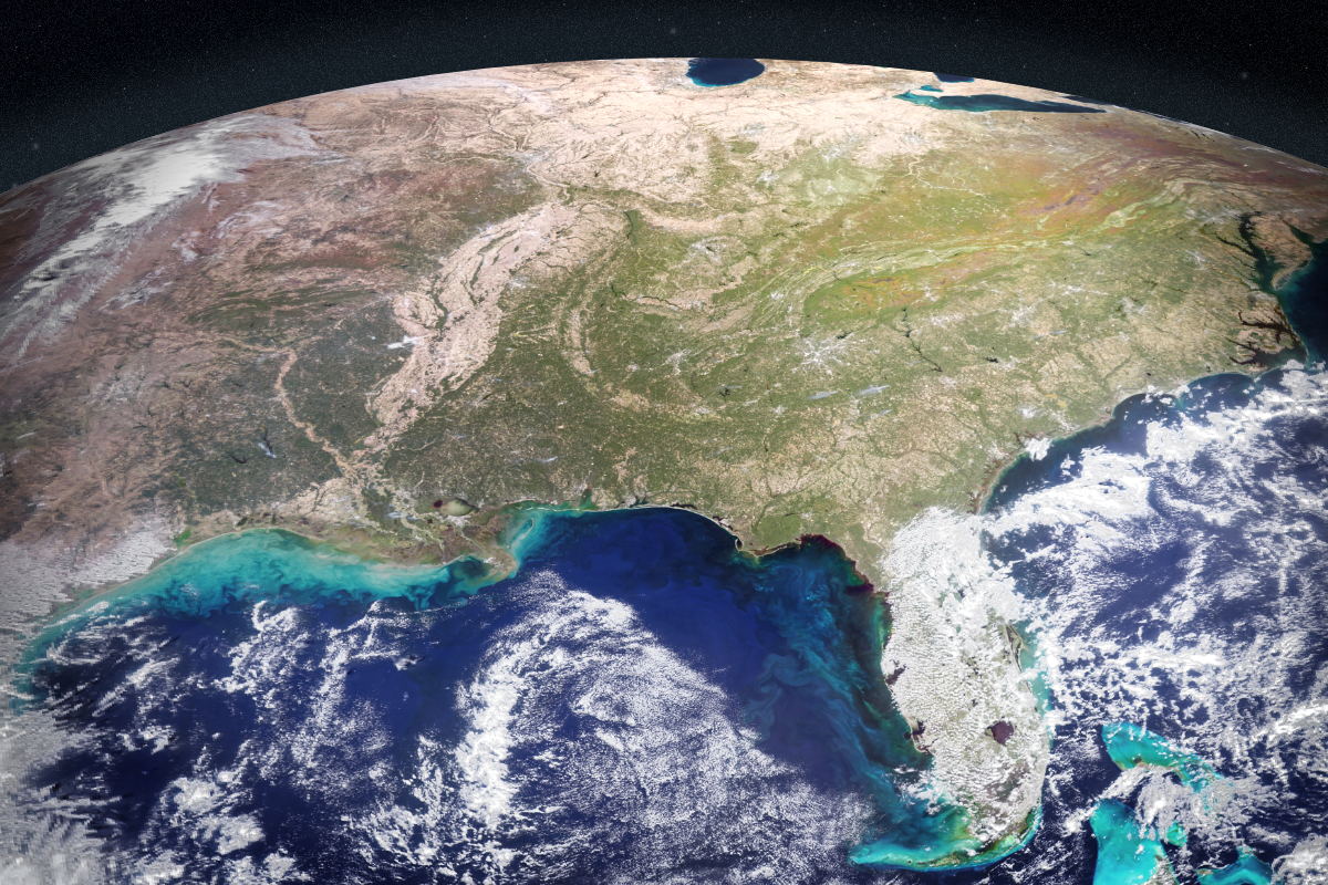
NASA scientists have developed an artificial intelligence tool to take on a longstanding challenge in ocean waters. In a study recently published in AGU Earth and Space Science, researchers reported the tool was able to fuse data from multiple satellites and detect harmful algal blooms that occurred in western Florida and Southern California.
Severe blooms can pose health risks and cost coastal economies in the United States tens of millions of dollars every year. Areas in Florida such as Tampa Bay and Sarasota have wrestled with the problem for decades. A species called Karenia brevis can thrive in Gulf of America waters, spawning harmful algal blooms that kill wildlife, foul beaches, and sicken swimmers. On the West Coast, blooms of Pseudo-nitzschia have poisoned hundreds of dolphins, California sea lions, and other marine animals in recent years. Toxins from algaecan even enter the air and cause respiratory illness in humans.
To manage the risk, health agencies regularly test waters and issue warnings or beach closures when necessary. The National Oceanic and Atmospheric Administration (NOAA) works with states and other local partners to issue harmful algal bloom forecasts, like weather forecasts, during bloom seasons.
On-site testing requires hours in a boat to manually collect water samples that must be sent to a lab for analysis, taking a day or more and requiring multiple tests. It’s even more challenging to know where to test before a bloom starts spreading.
NASA’s Earth-orbiting satellites already track harmful algal blooms with their unique global view. By bringing together diverse datasets, the new AI tool could serve as a force multiplier to help communities determine where to focus their efforts.
“At the very least, a tool like this can help us know where and when to collect water samples as an algal bloom is starting,” said one of the paper’s coauthors, Michelle Gierach, a scientist at NASA’s Jet Propulsion Laboratory in Southern California. “It can also drive collaboration between specialists, fostering new ways to conduct the science and deliver decision-support products.”
Today, satellites can detect a variety of clues that signal an algal bloom. A hyperspectral sensor aboard NASA’s Plankton, Aerosol, Cloud, ocean Ecosystem (PACE) satellite, for example, can identify algal communities by their size, shape, and pigment. Other instruments like TROPOMI (Tropospheric Monitoring Instrument) pick up on the faint red glow emitted by species such as K. brevis as they photosynthesize.
The study team, consisting of Gierach, Kelly Luis of NASA JPL, and research data scientist Nick LaHaye of Spatial Informatics Group, brought together findings from five space missions or instruments, including PACE and TROPOMI.
The challenge for them was the quantity of raw data involved. How would AI distinguish between deep water and a coastline? Could it recognize a bloom across different data streams? Would it ever be able to handle inputs from both satellites and sensors in the water?
The team developed a self-supervised machine learning system, designed to learn patterns from multiple kinds of satellite data and compare them with field observations. This approach enables AI to recognize relationships between different data sources without needing any labeling in advance.
The system was trained on satellite data collected in 2018 and 2019. Field and lab measurements were then used to add real-world context to the patterns that the system was recognizing. The scientists evaluated the tool’s performance across later time periods in the same geographic areas. Initial results indicate that it can correctly identify and map harmful blooms, including specific species like K. brevis, performing well even in complex coastal waters swirling with sediment, plants, and runoff.
“Applying self-supervised AI to massive streams of satellite data is rapidly becoming a powerful tool for generating actionable ocean intelligence,” said Nadya Vinogradova Shiffer, lead program scientist at NASA Headquarters in Washington.
The team is now improving the tool with more data from more coastlines and expanding tests to other kinds of water bodies, including lakes, with the goal of making it accessible to decision-makers in coming years.
“The aim of this work is to start to bridge technologies to better serve end users and their needs, from aquaculture to tourism,” Luis said. “To do that, we’re going to bring all our NASA assets to the table.”
Media Contacts
Andrew Wang / Andrew Good
Jet Propulsion Laboratory, Pasadena, Calif.
626-379-6874 / 818-393-2433
andrew.wang@jpl.nasa.gov / andrew.c.good@jpl.nasa.gov
2026-034
Explore More 2 min read Fire Chars Santa Rosa IslandThe blaze spread across the southern side of the second-largest island in California’s Channel Islands…
Article 19 hours ago 5 min read NASA’s Psyche Mission Aces Mars Flyby, Targets Metal-Rich Asteroid Article 1 day ago 3 min read Farming in Ancient Lake AgassizThe glacial lake left a layer of silt and clay in southeastern Manitoba, creating fertile…
Article 2 days ago Keep Exploring Discover More Topics From NASAEarth Observations
Earth Science Mission
Mission: PACEWhen did PACE launch? February 8, 2024 Where is PACE? 420 miles (676.5 km) from Earth What does PACE do?…
Jet Propulsion Laboratory
NASA-developed AI Could Help Track Harmful Algae
NASA scientists have developed an artificial intelligence tool to take on a longstanding challenge in ocean waters. In a study recently published in AGU Earth and Space Science, researchers reported the tool was able to fuse data from multiple satellites and detect harmful algal blooms that occurred in western Florida and Southern California.
Severe blooms can pose health risks and cost coastal economies in the United States tens of millions of dollars every year. Areas in Florida such as Tampa Bay and Sarasota have wrestled with the problem for decades. A species called Karenia brevis can thrive in Gulf of America waters, spawning harmful algal blooms that kill wildlife, foul beaches, and sicken swimmers. On the West Coast, blooms of Pseudo-nitzschia have poisoned hundreds of dolphins, California sea lions, and other marine animals in recent years. Toxins from algaecan even enter the air and cause respiratory illness in humans.
To manage the risk, health agencies regularly test waters and issue warnings or beach closures when necessary. The National Oceanic and Atmospheric Administration (NOAA) works with states and other local partners to issue harmful algal bloom forecasts, like weather forecasts, during bloom seasons.
On-site testing requires hours in a boat to manually collect water samples that must be sent to a lab for analysis, taking a day or more and requiring multiple tests. It’s even more challenging to know where to test before a bloom starts spreading.
NASA’s Earth-orbiting satellites already track harmful algal blooms with their unique global view. By bringing together diverse datasets, the new AI tool could serve as a force multiplier to help communities determine where to focus their efforts.
“At the very least, a tool like this can help us know where and when to collect water samples as an algal bloom is starting,” said one of the paper’s coauthors, Michelle Gierach, a scientist at NASA’s Jet Propulsion Laboratory in Southern California. “It can also drive collaboration between specialists, fostering new ways to conduct the science and deliver decision-support products.”
Today, satellites can detect a variety of clues that signal an algal bloom. A hyperspectral sensor aboard NASA’s Plankton, Aerosol, Cloud, ocean Ecosystem (PACE) satellite, for example, can identify algal communities by their size, shape, and pigment. Other instruments like TROPOMI (Tropospheric Monitoring Instrument) pick up on the faint red glow emitted by species such as K. brevis as they photosynthesize.
The study team, consisting of Gierach, Kelly Luis of NASA JPL, and research data scientist Nick LaHaye of Spatial Informatics Group, brought together findings from five space missions or instruments, including PACE and TROPOMI.
The challenge for them was the quantity of raw data involved. How would AI distinguish between deep water and a coastline? Could it recognize a bloom across different data streams? Would it ever be able to handle inputs from both satellites and sensors in the water?
The team developed a self-supervised machine learning system, designed to learn patterns from multiple kinds of satellite data and compare them with field observations. This approach enables AI to recognize relationships between different data sources without needing any labeling in advance.
The system was trained on satellite data collected in 2018 and 2019. Field and lab measurements were then used to add real-world context to the patterns that the system was recognizing. The scientists evaluated the tool’s performance across later time periods in the same geographic areas. Initial results indicate that it can correctly identify and map harmful blooms, including specific species like K. brevis, performing well even in complex coastal waters swirling with sediment, plants, and runoff.
“Applying self-supervised AI to massive streams of satellite data is rapidly becoming a powerful tool for generating actionable ocean intelligence,” said Nadya Vinogradova Shiffer, lead program scientist at NASA Headquarters in Washington.
The team is now improving the tool with more data from more coastlines and expanding tests to other kinds of water bodies, including lakes, with the goal of making it accessible to decision-makers in coming years.
“The aim of this work is to start to bridge technologies to better serve end users and their needs, from aquaculture to tourism,” Luis said. “To do that, we’re going to bring all our NASA assets to the table.”
Media Contacts
Andrew Wang / Andrew Good
Jet Propulsion Laboratory, Pasadena, Calif.
626-379-6874 / 818-393-2433
andrew.wang@jpl.nasa.gov / andrew.c.good@jpl.nasa.gov
2026-034
Explore More 2 min read Fire Chars Santa Rosa IslandThe blaze spread across the southern side of the second-largest island in California’s Channel Islands…
Article 19 hours ago 5 min read NASA’s Psyche Mission Aces Mars Flyby, Targets Metal-Rich Asteroid Article 1 day ago 3 min read Farming in Ancient Lake AgassizThe glacial lake left a layer of silt and clay in southeastern Manitoba, creating fertile…
Article 2 days ago Keep Exploring Discover More Topics From NASAEarth Observations
Earth Science Mission
Mission: PACEWhen did PACE launch? February 8, 2024 Where is PACE? 420 miles (676.5 km) from Earth What does PACE do?…
Jet Propulsion Laboratory
Hearing the Heavens - Book Review of The Echoing Universe
Typically when we think of astronomy, we think of pictures of M87 captured on a backyard telescope or the soaring colorful peaks of the Eagle Nebula seen by Hubble. But perhaps the most influential type of astronomy of the last 100+ years doesn’t directly result in the stunning pictures we’re so accustomed to today. It captures radio waves from some of the most interesting objects in the universe. And in her new book, The Echoing Universe: How Radio Astronomy Helps Us See the Invisible, Dr. Emma Chapman, a radio astronomer at the University of Nottingham, tracks how these longest wavelengths of the electromagnetic spectrum have influenced the practice of astronomy and our understanding of our place in the universe.